HIKING
Buzzardroost Rock Trail
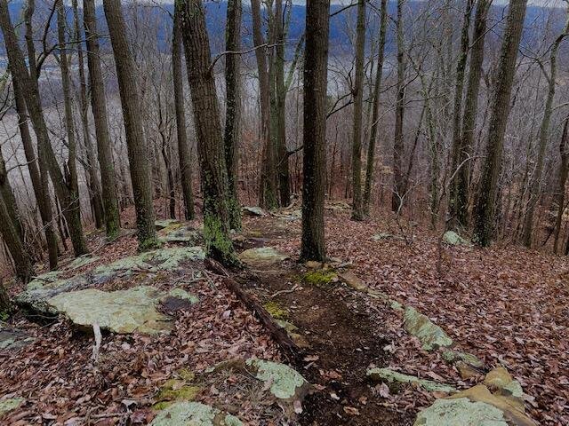
Buzzardroost Rock Trail is a 5.3 mile moderately trafficked out and back trail located near West Union, Ohio that features beautiful wild flowers and is rated as moderate. The trail is primarily used for hiking, nature trips, and bird watching and is best used from April until October. The most popular of all trails in the Edge of Appalachia Preserve system is the one that leads to Buzzardroost Rock, which stands like a giant limestone monument far above the waters of Ohio Brush Creek. The panoramic scene from this hilltop has been called Ohio’s most spectacular view. Preserve naturalists suggest that hikers plan to spend a minimum of two to three hours for the round trip, allowing time to observe the natural features along the way and enjoy the scenic view from the top of the rock.
The drive from McChesney Ridge is 26.2 miles or 34 minutes.
GPS Coordinates: 38°46'14.3"N 83°25'33.6"W
Google Drive Map: https://goo.gl/maps/MKNWnncAt1QF3F366
Buzzaredroost Web Site: Edge of Appalachia Buzzardroost Rock Trail | TNC in Ohio (nature.org)


HIKING
Raven Rock Trail
Raven Rock Trail is a 2.5 mile moderately trafficked out and back trail located in West Portsmouth, Ohio that features a view of the Ohio river and is rated as moderate. The trail is primarily used for hiking, walking, nature trips, and bird watching and is accessible year-round.
The drive from McChesney Ridge is 18 miles or 24 minutes.
GPS Coordinates: 38.718972, -83.050889
Google Drive Map: https://goo.gl/maps/QQg9ziwtDkdVLBw69
Raven Rock Ohio Historical Web Site: Raven Rock State Nature Preserve | Scioto Historical

HIKING
Rock Run Red Trillium Trail
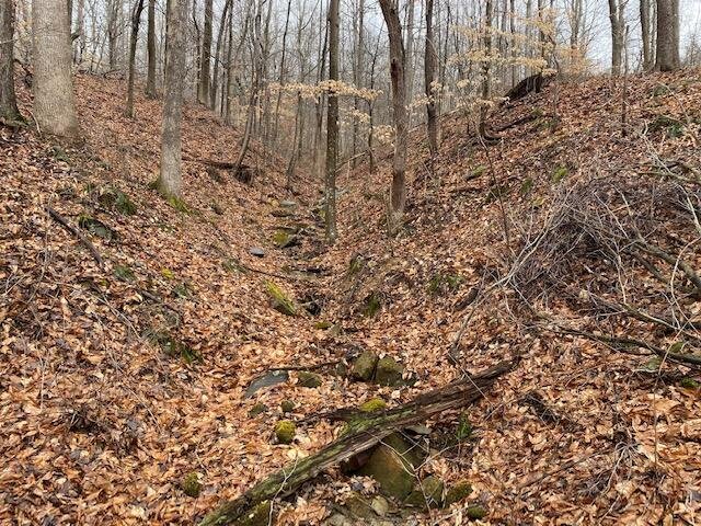
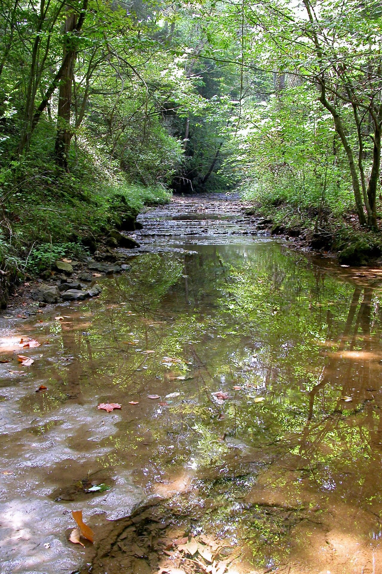
The Red Trillium Trail is a challenging but rewarding back country 3.3 mile trail with stunning views of the Ohio River below and the hills of Kentucky on its far shore. Rock Run is an incredibly picturesque landscape. After reaching the ridge-top from the base of the hill on HWY-52, the trail drops down into the rich woodlands of Trillium Hollow, where the sounds of the highway and the bustling enterprises of the Ohio River suddenly vanish. Here one is immersed in the deep woods – surrounded by birds songs, ferns, frogs, and native wildflowers. The historical remnants of the sandstone mining can be seen at many points along the trail, including massive 19th century boundary markers carved out of stone, as well as the large vernal pools that are now breeding habitat for a variety of amphibians. The trail then loops back to the ridge line, and back to the trailhead. The road entrance is fully signed to a graveled parking lot and the path is clearly marked with directional arrows. To see the Red Trilliums, visit in mid-April. Red Trillium Trail does permit dogs if kept on a 6-foot leash.
The drive is 34.8 miles or 41 minutes.
GPS Coordinates: 38.63207288883271, -83.28900866184492
Google Drive Maps: https://goo.gl/maps/beh8GfG2eLJ6u4qV6
Arc of Appalachia Rock Run Web Site: Rock Run Preserve Home | Arc of Appalachia


HIKING
Helen C. Black Trail at Cedar Falls
Helen C Black Trail at Cedar Falls is a 3.2 mile trail located near Blue Creek, Ohio that features a waterfall and is rated as moderate. The trail is primarily used for hiking, walking, and running. The best viewing of the waterfall is after a rain.
The drive is 23 miles or 32 minutes from McChesney Ridge.
GPS Coordinates: 38.90710629332419, -83.19102434809494
Google Drive Maps: https://goo.gl/maps/Q7bb4M5EbTBzfA4s6
Helen C. Black Trial Web Site: The Nature Conservancy

HIKING
Cinnamon Fern Trail Loop
The Cinnamon Fern Trail is 1.3 miles and offers a variety of features, from rich and abundant ferns and acidic soil loving plants, a hemlock grove, towering oak trees, and a large natural recessed sandstone cave. The trail descends toward the recess cave, with a small 20 foot waterfall cascading over its edge, then follows along the rich banks of the McConnell Creek, where large verdant cinnamon ferns grow in profusion. As the seasons shift into fall, the ferns change into a brilliant yellow, along with the vibrant colors of fall forest foliage.
The drive is 25.4 miles or 34 minutes.
GPS Coordinates:
Google Map Drive: 717 Posey Ridge Rd, Beaver, OH 45613
Cinnamon Fern Trail Web Site: Samson/Orbist Woods

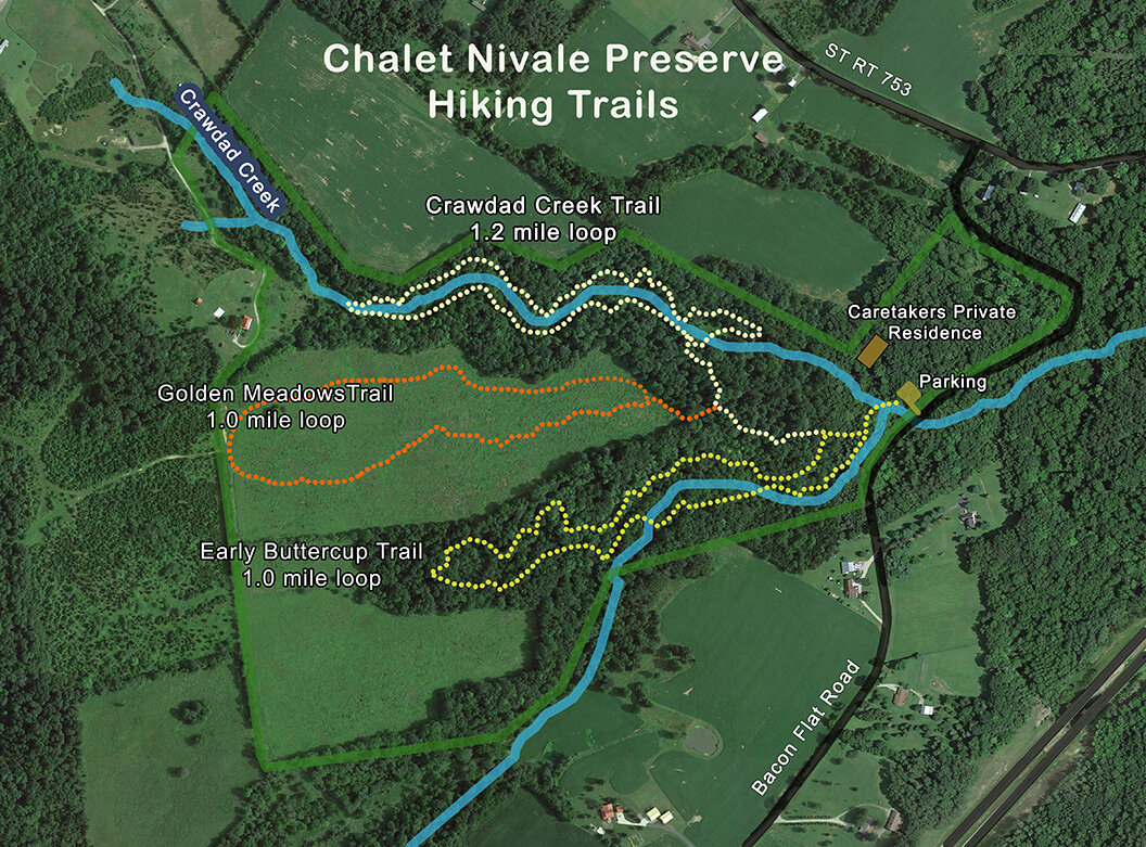
HIKING
Chalet Nivale
Chalet Nivale features two loop trails that meander through the low floodplain created by two short tributaries of Scioto Brush Creek that have sculpted the bedrock into mossy slump blocks and intriguing outcrops, bounded by vertical cliffs. A third trail dissects a meadow that lies like a low bowl – surrounded by a rim of Appalachian hills. The trail provides pleasant panoramas of the surrounding hill country, especially during fall color season. Before hiking, click here for hours and directions. There are several unimproved shallow stream crossings on Chalet Nivale Trails that require stepping on stones and therefore good balance. Please wear appropriate foot gear and do not hike after a series of heavy rains. In normal weather the water is 2-3 inches deep. Because the Chalet Nivale is a world-class destination for wildflowers that grow immediately bordering the trails which are vulnerable to compaction and disturbance, dogs are not permitted on trails.
The drive is 18.6 miles or 27 minutes.
GPS Coordinates: 38.98847179624057, -83.34792692416552
Google Map Drive: Chalet Nivale
Chalet Nivale Web Site: Chalet Nivale Home
HIKING
Shawnee State Forest Trails
Looking for a great trail in Shawnee State Park. They have 10 trails for your hiking pleasure. Located in Shawnee State Forest, Shawnee State Park features views of the Appalachian foothills and the Ohio River. As this area was once used by the Shawnee Indians as hunting grounds, this park contains the most picturesque views in the state. The beauty of this area includes wooded hills and erosion carved valleys, earning its name of "The Little Smokies."
The drive is 18.7 miles or 34 to Shawnee State Park from McChesney Ridge
GPS Coordinates: 38.726550,-83.171730
Google Map Drive: Shawnee State Park
Shawnee State Forest Web Site: Shawnee State Forest


HIKING
McChesney Ridge Trails
3 miles of well groomed trails.
The drive is 0 miles and 0 minutes!